Seismic surveying on land
Seismic surveying is a powerful geophysical method used to investigate subsurface conditions without excavation. It helps identify bedrock depth, detect weak zones, and support planning for construction, infrastructure, and geohazard mitigation.

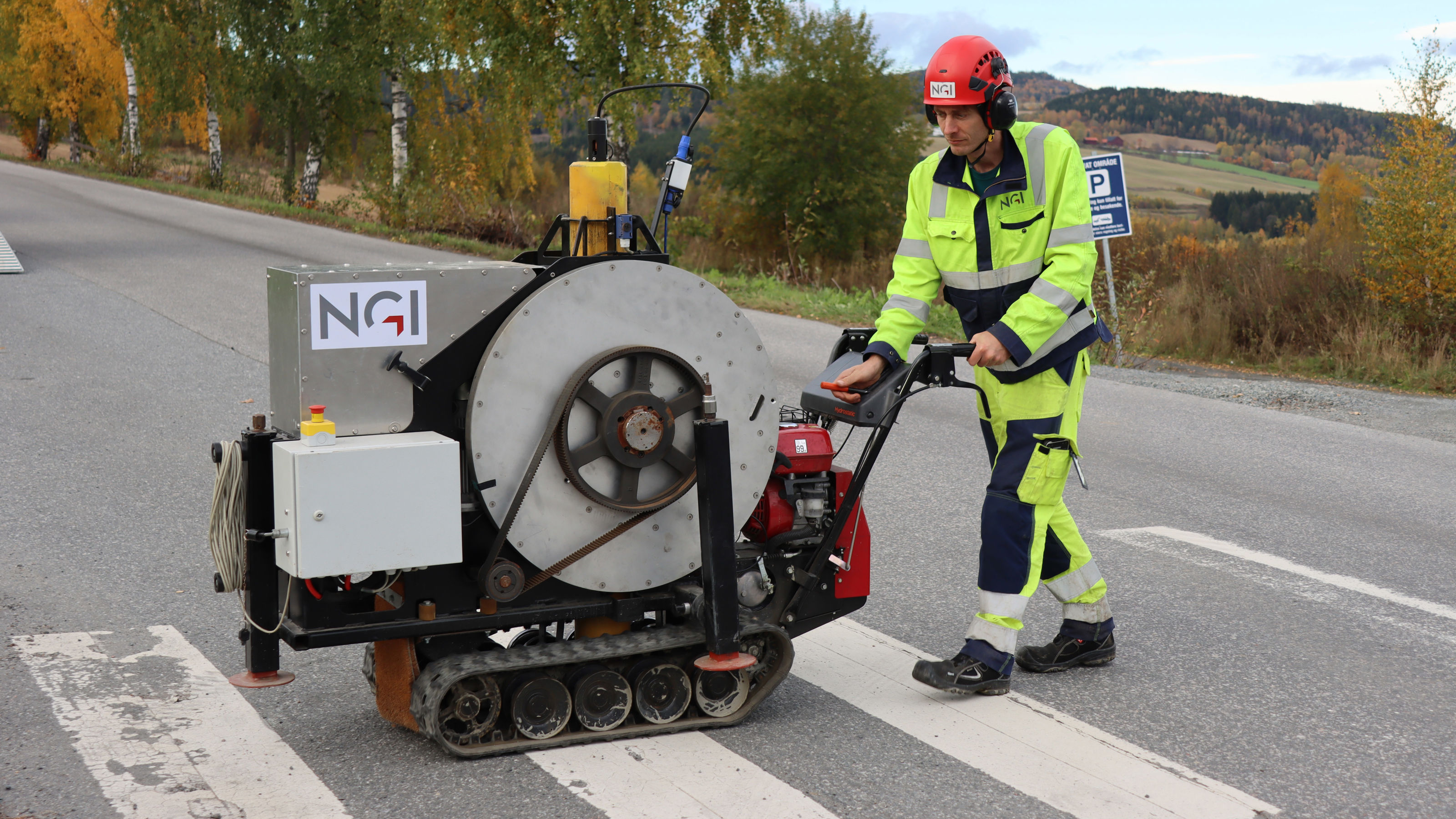
Mjølner, NGI’s custom-built sledgehammer beast!
Applications and Value for Infrastructure Planning
Seismic surveying is a critical tool in the early stages of infrastructure development. By providing detailed information about subsurface conditions, it enables engineers and planners to make informed decisions before construction begins. This can significantly reduce uncertainty and risk, especially in areas with complex geology or limited prior data.
Key applications include:
- Mapping bedrock and sediment layers: Understanding the depth and composition of subsurface layers helps optimize foundation design and avoid costly surprises during excavation.
- Identifying fault zones and unstable ground: Early detection of geohazards such as faults, landslides, or weak zones allows for safer routing of infrastructure and targeted mitigation measures.
- Supporting tunnel and foundation design: Accurate seismic data ensures that tunnels, bridges, and buildings are designed with appropriate support structures, reducing the likelihood of structural issues.
- Monitoring landslides and other geohazards: Seismic methods can be used to track changes over time, supporting long-term safety and maintenance planning.
By investing in seismic surveys early in a project, developers can achieve substantial cost savings through reduced need for reactive measures, optimized design, and fewer delays. NGI’s expertise in adapting seismic methods to urban, mountainous, and Arctic environments ensures reliable results even under challenging conditions.
NGI conducts seismics using different methods
The waves' speed and direction in the ground depending on the mass density. When the waves meet a difference between two different materials, some waves are reflected, some continue, while some follow the interface at high speed (so-called refraction). When the seismic waves reach the surface, they are detected by acoustic sensors (called geophones), and the seismic data is processed and interpreted.
NGI uses three-component digital geophones (wireless and wired) that detect both P- and S-waves and are not affected by electromagnetic noise. The system further allows real-time control of collected data and acoustic noise monitoring. Several different sources can be used, e.g. sweep vibrators or dynamite. NGI has developed a powerful P-wave source that provides up to 4 kJ repeatable strokes with a 160 kg weight.
Several seismic methods exist for different applications, depending on what kind of waves are generated and registered and how these are processed.

Example of tomographic inversion of refraction seismic data. The profile indicates a zone of weathered rock at 80 m, which may be a zone of weakness.
Advanced Cableless Seismic Capabilities
NGI has long been equipped to carry out complex and large-scale seismic operations across Norway and internationally. In 2025, we expanded our toolkit with a cutting-edge cableless seismic system from Stryde, further strengthening our ability to deliver high-resolution subsurface data in even the most challenging environments.
The system is built around STRYDE Nodes™, the world’s smallest and lightest autonomous seismic sensors. These cableless units allow for rapid, high-density deployment with minimal logistical effort, making them ideal for use in rugged terrain, urban settings, and sensitive Arctic landscapes.

STRYDE Nodes™
Enhanced Operational Flexibility
- Fast and efficient deployment with reduced crew size and minimal environmental impact
- High-density data acquisition for improved imaging of subsurface structures
- Adaptable to both active and passive seismic methods
Passive Seismic Monitoring
The system also enables passive seismic monitoring, where ambient vibrations are recorded over time without the need for active sources. This opens up new possibilities for:
- Monitoring slope stability and landslide activity
- Detecting microseismic events and ground motion
- Assessing dynamic soil behavior near infrastructure
Supporting long-term environmental and geotechnical studies
With this system, NGI continues to offer some of the most advanced seismic capabilities available, combining deep technical expertise with flexible, field-proven technology to support infrastructure planning, geohazard assessment, and scientific research.

STRYDE Nodes™ deployment

Dyre Oliver Dammann
Head of Section Remote Sensing and Geophysics Remote Sensing and Geophysics dyre.dammann@ngi.no+47 930 10 310

Dylan Mikesell
Principal Geophysicist Remote Sensing and Geophysics dylan.mikesell@ngi.no+47 922 43 164